Copernicus satellites help to protect Europe’s coastal zones

01 December 2020

What role do satellites play in sustainable management of coastal zones? Telespazio Iberica, along with other enterprises in the geoinformation sector, recently completed the first half of the Coastal Zone project, set up to monitor the areas in which the continent meets the sea.

The coastal zones are an essential part of the European economy. One needs simply to consider that 40 % of the European Union’s population live within 50 km of the sea, and that more than a third of the Continent’s GDP is generated in these areas. And that’s not all, an impressive 75% of the Continent’s foreign trade is transported by sea.

However, the coast’s role as crossroads for people and freight traffic also takes its toll on the environment, in terms of pollution, erosion, and loss of habitats. The threat facing these zones calls for sustainable management, able to combine development interests with the need to maintain healthy, resistant marine ecosystems.

For this reason, since 2013, the European Union has been involved in setting up suitable policies for planning the marine areas, and integrating all the member Countries’ policies in this regard.

One essential aspect for attaining this goal is the satellite data from the European Copernicus Programme, which makes temporal and spatial analysis possible, that would otherwise be impossible, thereby helping the authorities to establish long-term policies.

As part of the Copernicus - Land Monitoring Services (CLMS) programme, and in close collaboration with the Marine environment monitoring service (CMEMS), Coastal Zone product has been created, in which a primary role was played by Telespazio Iberica, a Telespazio subsidiary with offices in Barcelona and Madrid. 

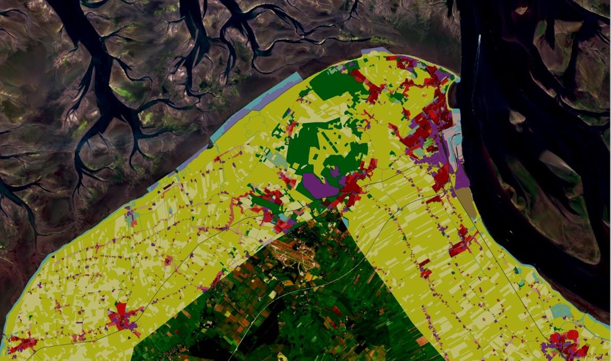
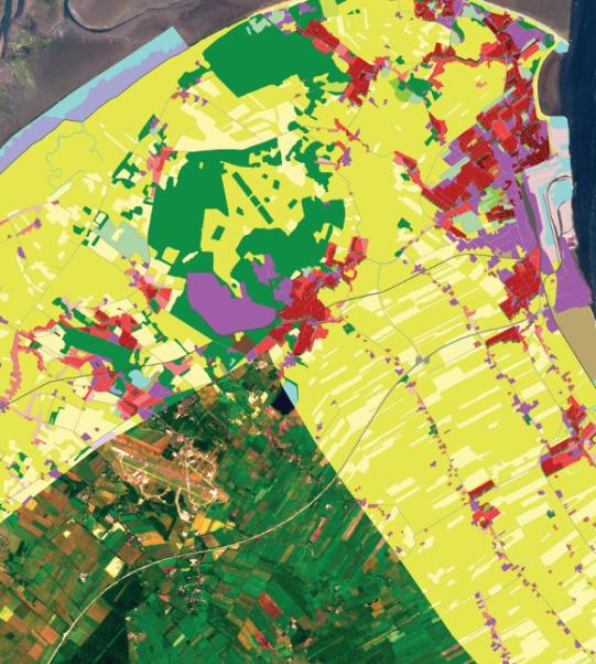
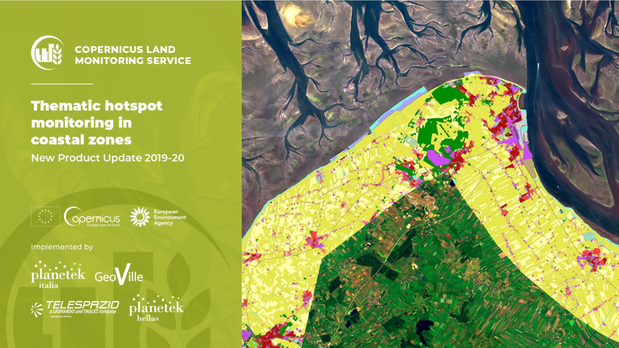
In recent days the CLMS has made public the 100% of the data first provided in September by the Coastal Zone project, which, besides Telespazio Iberica, involves Planetek Italia, Planetek Hellas and Geoville. Together they have provided the data of the entire coast monitoring activity, covering the period 2012 - 2018.

In particular, the Coastal Zones project includes mapping the coastal areas and evolving usage of the territory for the reference period. It brings to light how human intervention has changed these areas. Thanks to the data from this project, the European authorities will have access to a tool that can be used for making long-term decisions, to guarantee the sustainability of the environment in which we live.

The Coastal Zone project is the latest example of how space and sustainability are two closely connected worlds. This is a bond that the Telespazio Group has taken to heart, and that is confirmed in our day-to-day work, dedicated to the planet and safeguarding it.

Other News & Stories

09.10.2025
Winners of the Telespazio Innovation Award 2025 Announced in Rome

Engineering creativity and tangible space applications: the joint Innovation Award by Telespazio and Leonardo’s Space Division returns, celebrating the most visionary and promising projects of 2025.

06.10.2025
Renewed Assignment to Telespazio and e-GEOS for the Operational Management of the COSMO-SkyMed Satellite System of the Italian Space Agency (ASI) and the Ministry of Defence

Telespazio, as lead company of the Temporary Business Grouping (RTI) with its subsidiary e-GEOS (a joint venture between Telespazio and ASI) as partner, has been awarded the renewal of the Operational Management and Maintenance in Operational Conditions (MCO) activities of the COSMO-SkyMed satellite system, the Earth observation radar programme owned by the Italian Space Agency (ASI) and the Ministry of Defence.

26.09.2025
Telespazio leads the development of MINERVA, ASI’s national project for GNSS monitoring dedicated to drones

Telespazio plays a central role in the development of MINERVA, the project entrusted and funded by the Italian Space Agency (ASI) for GNSS signal monitoring in support of drone and remotely piloted aircraft navigation within Italian airspace.

24.09.2025
The Leonardo Group brings its excellence and innovation in Earth Observation to Australia

Leonardo, through e-GEOS, will introduce its high value-added Earth Observation solutions to the Australian and Indo-Pacific markets. The adoption of the most advanced geospatial technologies in the region will contribute to strengthening national resilience, environmental monitoring and digital transformation processes.