


The services will be supplied via the MapCy platform, which provides users with rapid geographic information supporting emergency response initiatives and business intelligence.
The services supplied will satisfy the requirements of emergency response services in Near Real Time, providing standard or customised geographical data and maps.
“We proud to support the Lazio Region with e-GEOS’s many years of consolidated experience in emergency response, which has been our company’s pride in Europe and the world over for many years”, Paolo Minciacchi, CEO of e-GEOS.
“This is the kind of thing we like to see in Italy: e-GEOS is an important Leonardo Group company, a European leader in the field of satellite solutions and services, based right here in Lazio. The agreement with the Civil Protection of the Region of Lazio offers an example of how aerospace technologies can contribute to generating innovation and collaboration which concretely improves people’s lives”.
Paolo Orneli, Councillor for Economic Development, Commerce and Trades, Universities, Research, Start-Ups and Innovation.
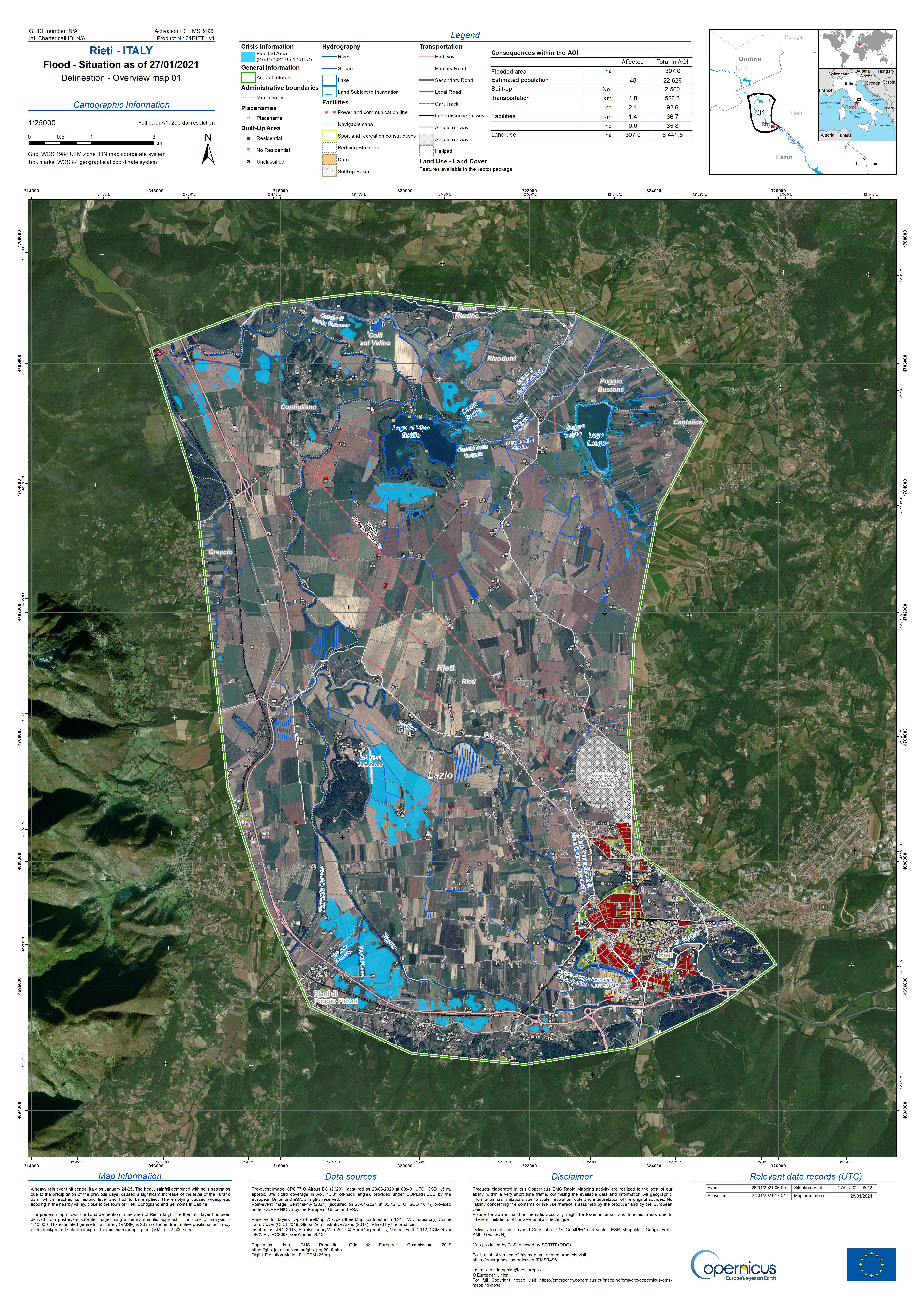
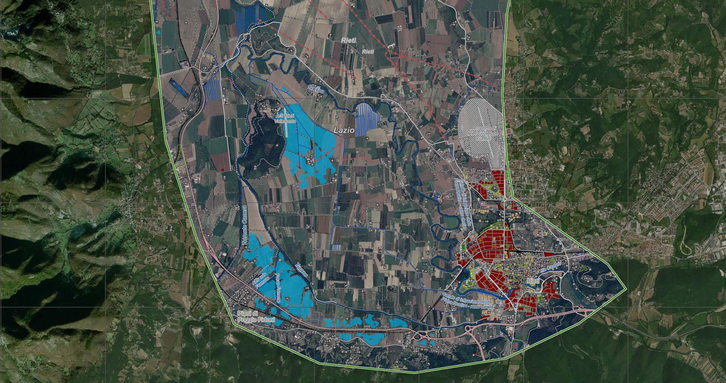
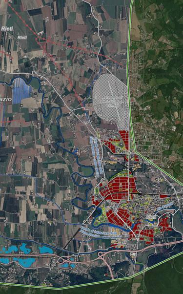
“The Civil Protection Department of the Lazio Region is completing its IT platform (SEIPCI) for management of all its institutional activities, from incident management in the operations room to management of volunteer work, vehicles and equipment, from training to reconnaissance and estimation of damage caused by natural disasters. At the same time”, he adds, ”we are working on a platform module for planning of civil guard activities, which, by collecting and sharing information on plans, dialogues with other management modules and permits optimal use of all the information produced in the Regional Operations Centre and all our daily forecasting, monitoring and surveillance work for risk prevention. A further contribution is offered by the satellite maps supplied under the European Copernicus-EMS programme, which were, for example, used in when the Rieti plain was flooded in February 2021”.
Carmelo Tulumello, Director of the Civil Protection Department of the Lazio Region.
e-GEOS, offering the entire range of emergence response services for the Leonardo Group, holds a position of leadership in geoinformation in Europe and is the consortium leader that provides the Copernicus EMS Rapid Mapping Service for the European Commission since 2012. e-GEOS’s Emergency Team, active 24 hours a day, 7 days a week, includes highly specialised professionals supplying products and services based on satellite imaging to support responses to natural disasters, industrial accidents, humanitarian crises and major events all over the world.
e-GEOS supplies pre-event products, that is, maps of the area affected by the emergency generated using archive images and data, to provide up-to-date information on roads, buildings and infrastructure prior to the incident - and post-event products for the areas affected. All products are based on satellite images acquired during or immediately after the event, using the most appropriate type of sensor: satellite (optical or radar), airplane or drone, integrating this data with information obtained from social media or on-site.