


In the summer nights, the temperature of some city centre areas can exceed the value measured by thermometers in rural areas even by 6-7 degrees.
This is a phenomenon all of us - unfortunately - directly experienced, called “urban heat island” by both city planners and architects.
Every city has its own “heat islands”, determined by the specific peculiarities of the urban context, but the common causes concurring to their creation have been identified over the years: these include the massive use of asphalt and concrete, the height of the buildings, the lack of green areas and, generally, the presence of dark surfaces.
The latter tend to absorb and retain heat, which consequently concentrates in small but densely inhabited areas. Hot air exhausts from HVAC systems and vehicular traffic worsen the issue.
Studying the “heat island” phenomenon can help us to better design and adapt our cities and also to fight the climate change at the same time.
The Milan metropolitan area, with 41% of its territory covered by built-up areas and infrastructures and with a population density exceeding two thousand people per square kilometre, is particularly subject to the “heat island” phenomenon, especially in its northernmost municipalities.
For this reason, to figure out how to prepare the city for the challenge of climate warming and to understand how “heat islands” originate and develop, the Milan Metropolitan City launched the Life METRO Adapt project, financed by the European Union, with the involvement, besides associations such as Legambiente and Ambiente italiana, and of CAP Holding and ALDA, of e-GEOS, a Telespazio (80%) and ASI (20%) company that is among the leading players in the satellite geo-information and remote sensing industry.
The Life METRO Adapt Project
Earth observation satellites, orbiting over 300 kilometres above our heads, allow us obtaining accurate and fresh data about our territories.
This makes possible to produce increasingly accurate maps and cartographic products, which help authorities to plan adaptation actions and to design the most proper responses. And not only, satellite data also provide continuous monitoring, a feature that allows to - quickly - update the collected information over time.
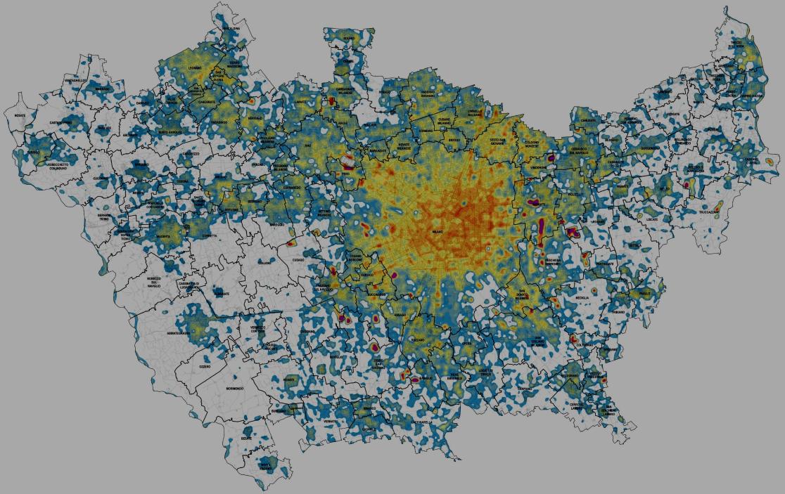
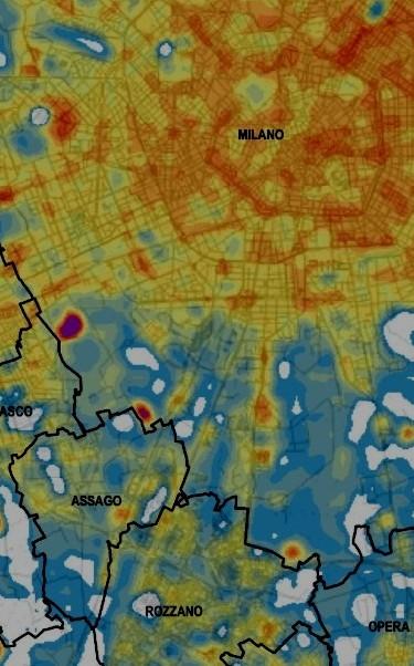
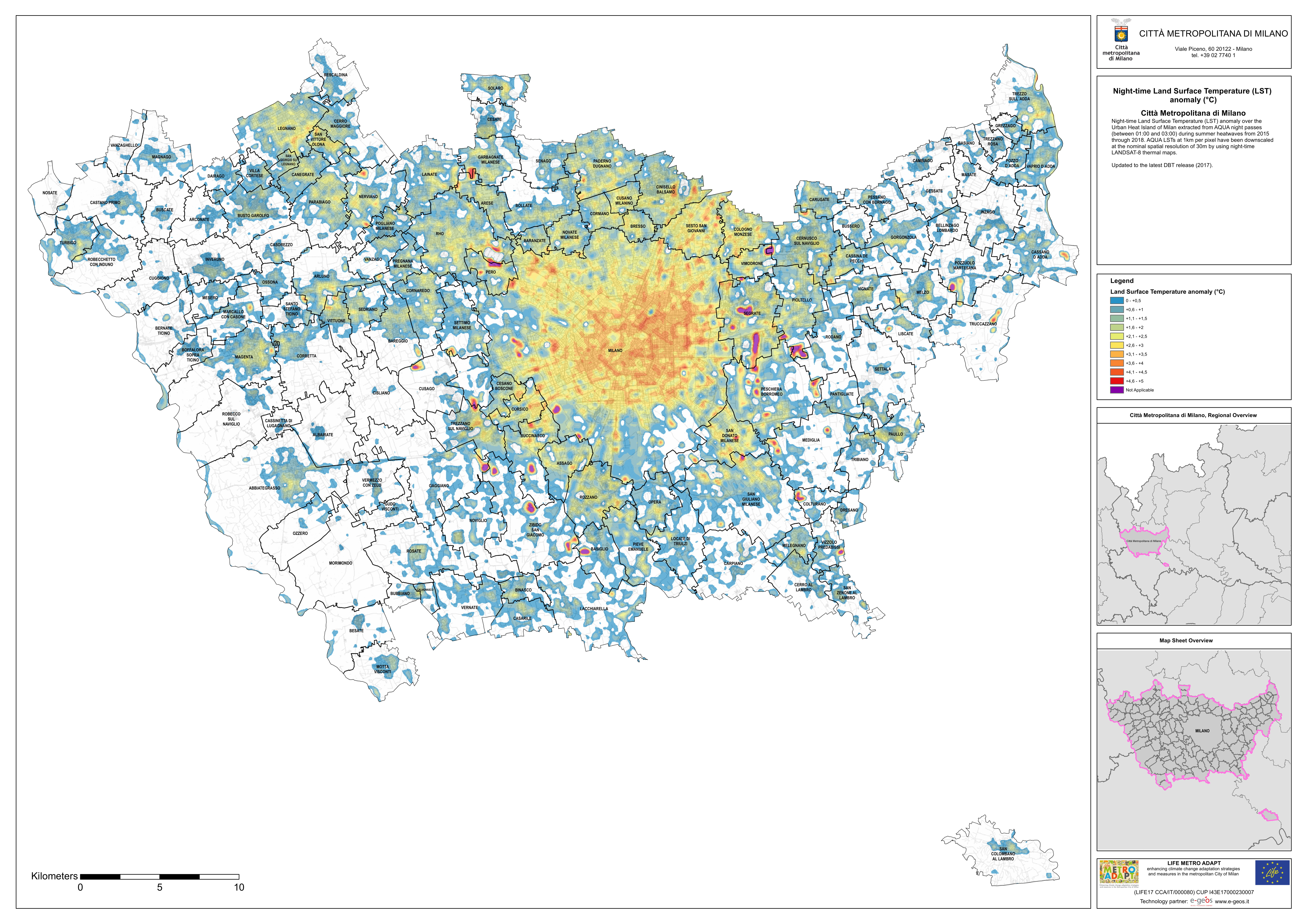
In the Life METRO Adapt project, for instance, e-GEOS has provided satellite maps capable of showing the night thermal anomalies in the Milan area during the summer heat waves from 2015 to 2018.
In particular, for the Milan area e-GEOS, has used the data of the American Terra (Modis) and Landsat 8 missions, defining 5 classes of ground thermal anomalies. Thanks to the data collected by satellites, it has been possible to create maps of the Milan Metropolitan City that clearly and univocally show the areas most affected by “heat islands” in the 2015-2018 period.
The data associated with thermal anomalies have then been integrated with the ISTAT data about the city population, thus identifying at territorial level (by census classes) the categories of citizens more vulnerable to heat waves, such as the elderly and the children.
The combined use of satellite data and of sensitive population data has allowed creating risk maps capable of providing the city authorities with a clear picture of the situation in case of “heat islands” and making available all the instruments to implement any corrective actions, both in the civil protection and city planning areas.