Safer drones over cities: Telespazio tests new satellite technologies

Turin  02 August 2019

Telespazio has successfully carried out, within the purview of the Torino City Lab/DORALab initiative, promoted by the Piedmontese capital in collaboration with ENAC, TIM and the Turin Polytechnic, a campaign of experimental flights (Full Flight View) with several RPAS (Remote Piloting Aircraft System) platforms. The tests have been carried out using the aircraft of our partner ADPM Drones, equipped with technologies provided by Telespazio, e-GEOS, DBW Communication and MPB.

Full Flight View (F2V), a project entirely funded by the companies of the industrial team led by Telespazio, has been conceived for public utility purposes, in particular to test new safety procedures for drone operation - a subject of interest for ENAC - and to develop innovative applicative products and services aimed at territorial control for the city of Turin, with sate-of-the-art utilisation and accuracy modes.

“The demonstrative activities carried out within the purview of the F2V project have allowed highlighting the role and potentiality of the satellite segment in the development and realisation of services making use of RPAS platforms - explains Marco Brancati, CTO of Telespazio –. The use of a high-accuracy reference system with images taken by satellites and aircraft, the real-time transmission of the integrity information of the drone position GNSS navigation signal and, for the first time, the remote control of the drone also taking place thanks to the transmission of the position and of commands through a satellite communication system, have proven the capability of introducing safety levels higher than the actual standards. Telespazio, through the F2V project, confirms its role in the development and realisation of services in which unmanned systems play a significant part, even in view of the future 5G market”.

The flight campaign involved drones of different typologies (fixed- and rotary-wing types, with weight ranging from 2 to 8 kg), equipped with Iridium satellite terminals, which guaranteed aircraft control in a BVLOS (Beyond Visible Line Of Sight) operational scenario where ground communication networks have failed.

The peaceful drones made by ADPM Drones, the lightest of the fleet (less than 300 grams) have also been used for two different asset management and urban security scenarios.

In the first scenario, e-GEOS, through a satellite interferometric analysis capable of detecting areas and structures affected by deformation phenomena, has identified, by means of the drones, a "Provincial Road Viaduct" providing real-time high-quality photo shoots and thermal TV camera images to the operation centre. Requests for prompt intervention - if required - are automatically generated by the system.

In the second case, the “I Run Safescenario has been tested. In this scenario, any individual practising sports in the city parks can, in case of need, draw the attention of a drone capable of transmitting real-time videos and data to the operation centre. The performance of such operation is completely automated, with no pilot intervention.

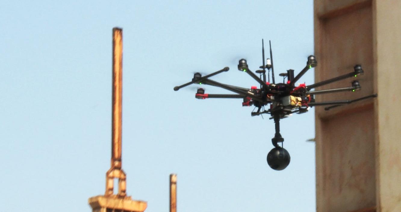
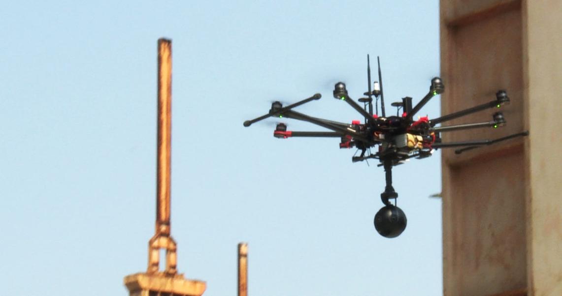
For applicative purposes, the F2V project has integrated new generation instrumentation for the measurement of the electro-magnetic field (SEP sensor provided by MPB) and a 4k 360° camera, provided by DBW Communication. DBW Communication has specifically developed a real-time Virtual Reality environment to display the 360° videos, the measurement of the electro-magnetic field intensity and the drone position integrity information, all of them in a 3D precision environment provided by e-GEOS. The data collected by onboard sensors, moreover, can be used by the e-GEOS AWARE platform and integrated with multi-source and multi-time data (satellite, aircraft, IoT, laser scan, municipal cartography, etc.).

Other News & Stories

11.03.2024
The English edition of "Space In our Hands" presented by Telespazio and the Bocconi SEE Lab

The English edition of Space In our Hands, published by Mimesis International, was presented in Milan on 7 March. The book, already available in Italian in a version published by Hoepli, is the result of a project of Telespazio and of the SEE Lab (the Space Economy Evolution Lab of the SDA School of Management) and is dedicated to sustainability, an increasingly hot topic both on Earth and in space.

07.03.2024
Telespazio Germany and constellr: A cooperation to improve our planet’s health

Telespazio Germany and constellr have signed an agreement for the provision of Telespazio’s ground segment software solution, EASE-Rise, to operate constellr’s first satellite. The upcoming launch, scheduled for later this year, aims to provide global land surface temperature (LST) imagery, contributing to the fight against climate change.

27.02.2024
Telespazio is taking part in “Drones and advanced air mobility: flying into the future, between challenges and opportunities”

Next Wednesday, 28 February, Telespazio will be among the participants in the meeting “Drones and advanced air mobility: flying into the future, between challenges and opportunities”, organised by the Drones and Advanced Air Mobility Observatory of the Politecnico di Milano, which Telespazio has been a partner of since 2021.

15.02.2024
The ASI AGILE satellite has re-entered the atmosphere, after being managed in orbit for 17 years by Telespazio

After 17 years of activity, AGILE (Astrorivelatore Gamma a Immagini LEggero, Light Imager for Gamma-ray Astrophysics), the scientific satellite of the Italian Space Agency (ASI), has re-entered the atmosphere. The “passivation” of the satellite, as required by international standards, was correctly carried out on 18 January by the Telespazio technicians in the Fucino Space Centre.