The italian support to usa for the Harvey emergency

Rome  01 September 2017

Thanks to the satellite constellation COSMO-SkyMed managed by the Italian Space Agency (ASI) and the Italian MoD, Italy plays a key role in Hurricane Harvey Emergency Support. The maps already available for the area, provide impact data on Houston, Corpus Chirsti and all major cities and submerged inhabited areas.

e-GEOS is the distributor of Italian constellation data and thanks to its network of agreements with major US Data Analysts - URSA and Orbital Insight -, it is supporting private and public entities involved in Emergency management, providing images that can detect large-scale impact, and will secure constant monitoring of the situation in the coming days, still considered critical.

ASI, through e-GEOS, is at the center of the analysis and information system that is supporting the government agencies involved using the Copernicus-EMS (the world's largest Emergency Support System), contract with European Commission with prime role of e-GEOS leading a European consortium of companies.

The #emergency and #RapidMapping team, in which besides e-GEOS and its German subsidiary GAF is also active the Italian Ithaca, is operating h24 updating with new data the areas of interest.

Value-added products are made possible by the e-GEOS platform, FLOOD , which allows to have the first estimates of affected areas, just few hours after receipt of satellite data.

Important sources of appreciation have come from European authorities, from the highest representatives of the European Commission and directly from the US organizations involved in the post event management, as well as European and American citizens.

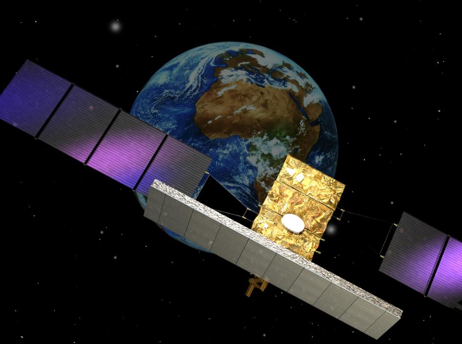
"COSMO-SkyMed  is a scientific and technological excellence, thanks to the skills of the Italian space industry, the joint ventures Thales Alenia Space and Telespazio," said Roberto Battiston, President of the Italian Space Agency. "I would also like to point out that, thanks to the ASI institutional network and the e-GEOS management capability, this constellation is a world-wide standpoint in emergency management and rapid mapping. A global community service that with the second generation of new COSMO satellites will be even more efficient ",

Massimo Claudio Comparini, CEO of e-GEOS, commented: "Emergency management is one of the many activities in which space technologies, and in particular Earth Observation, shows its full impact on society and economic activities. e-GEOS in this context contributes to cutting-edge solutions based on the use of the COSMO-SkyMed radar constellation, the data fusion with optical data, and more and more the development and processing of high-quality information products (Data Analytics). It's a must to warmly thank all the operational teams that are facing this period of emergencies with intensive work done also on fires monitoring and other natural hazards that have hit Italy and Europe over the past few weeks "

Thanks to a bilateral agreement, ASI supplies 7,000 COSMO-SkyMed images to NASA each year. Emergency activations are also planned in this framework, such as Harvey Hurricane.

ASI is institutionally supporting the NASA Jet Propulsion Laboratory in Pasadena with the supply of both archive images and new acquisitions, particularly in the Houston area affected by the hurricane in question.

Other News & Stories

11.03.2024
The English edition of "Space In our Hands" presented by Telespazio and the Bocconi SEE Lab

The English edition of Space In our Hands, published by Mimesis International, was presented in Milan on 7 March. The book, already available in Italian in a version published by Hoepli, is the result of a project of Telespazio and of the SEE Lab (the Space Economy Evolution Lab of the SDA School of Management) and is dedicated to sustainability, an increasingly hot topic both on Earth and in space.

07.03.2024
Telespazio Germany and constellr: A cooperation to improve our planet’s health

Telespazio Germany and constellr have signed an agreement for the provision of Telespazio’s ground segment software solution, EASE-Rise, to operate constellr’s first satellite. The upcoming launch, scheduled for later this year, aims to provide global land surface temperature (LST) imagery, contributing to the fight against climate change.

27.02.2024
Telespazio is taking part in “Drones and advanced air mobility: flying into the future, between challenges and opportunities”

Next Wednesday, 28 February, Telespazio will be among the participants in the meeting “Drones and advanced air mobility: flying into the future, between challenges and opportunities”, organised by the Drones and Advanced Air Mobility Observatory of the Politecnico di Milano, which Telespazio has been a partner of since 2021.

15.02.2024
The ASI AGILE satellite has re-entered the atmosphere, after being managed in orbit for 17 years by Telespazio

After 17 years of activity, AGILE (Astrorivelatore Gamma a Immagini LEggero, Light Imager for Gamma-ray Astrophysics), the scientific satellite of the Italian Space Agency (ASI), has re-entered the atmosphere. The “passivation” of the satellite, as required by international standards, was correctly carried out on 18 January by the Telespazio technicians in the Fucino Space Centre.