18 December 2025 12:00
e-GEOS, a joint venture between the Italian Space Agency (20%) and Telespazio (80%), part of the Leonardo Group, has been awarded a four-year contract with the Italian Navy for the provision of geospatial data and services supporting integrated maritime surveillance.
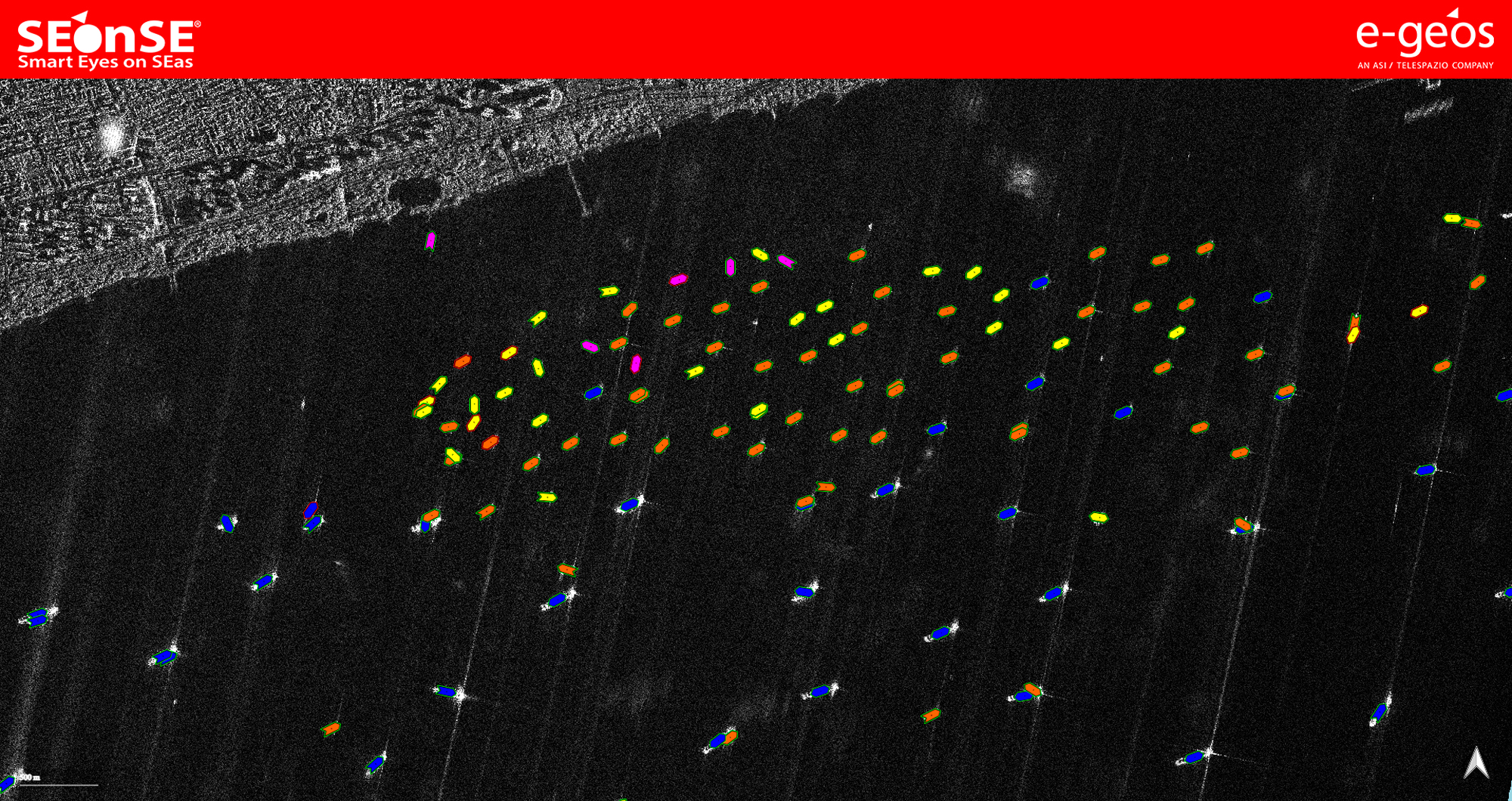
e-GEOS will guarantee access to a wide range of data from optical and radar satellite, AIS and Radio Frequency sources, as well as encyclopedic databases and the proprietary platform SEonSE (Smart Eyes on SEas), specifically focused on data for monitoring and protecting the marine environment. The integration of these geospatial sources characterised by varying spatial and temporal resolution will enable systematic and uninterrupted monitoring of operational scenarios for prompt identification of any anomalies at sea.
The Navy has already successfully tested the SEonSE capabilities in operation under previous agreements. Numerous interactions between e-GEOS laboratories and the Italian Navy Operations Centre have permitted the development of new solutions and functions, improving and adapting the platform to respond to real operative requirements through constant synergistic interaction.
“e-GEOS has been supporting the Navy for years, in line with the Leonardo Group’s vision, reflecting its mission of supporting Italy’s strategic requirements through innovative, high value-added geospatial solutions”, commented C. Milena A. Lerario, CEO of e-GEOS. “This new contract confirms the strength of a partnership built on trust, innovation and use of advanced geospatial technologies. With access to an extensive portfolio of satellite data and the analytical capabilities of our platforms, e-GEOS offers essential tools for enhancing maritime surveillance, safety and protection of the seas."
"Thanks to a combination of satellite data, new generation algorithms, artificial intelligence and advanced computing capabilities, we bring the best of Earth Observation to daily operations with the Navy, strengthening integrated maritime surveillance and protection of the seas," added Massimo Claudio Comparini, Managing Director of Leonardo's Space Division. "Leonardo believes in the strategic value of data and digitisation and continues to invest - starting with the new Leonardo constellation integrating optical and radar sensors - to ensure greater frequency, continuity and quality of data acquisition supporting decision-making. We implement cutting-edge technologies and our industrial capabilities with great commitment to the security and sovereignty of our country.”
With access to data from the COSMO-SkyMed constellation - of the Italian Space Agency and the Italian Ministry of Defence, for which e-GEOS is the exclusive licensee of data for commercial use - and a vast portfolio of agreements with key international satellite operators, the company can rely on an extensive geospatial database. Combining this data with the advanced analytics capabilities of the SEonSE platform, e-GEOS has developed strong expertise in the maritime domain. The applications provided include maritime traffic surveillance, detection of anomalous behaviour and monitoring of activities along the route of critical underwater infrastructure.