Satellogic and Telespazio Brasil Sign Agreement to Provide Satellite Imagery to the Brazilian Air Force

06 February 2025

The agreement ensures fast access to Satellogic's NewSat constellation and Aleph platform for enhanced defense and security monitoring.

The Brazilian Air Force (FAB) will benefit from low-latency satellite imagery for its defense and security operations through a multi-year agreement signed with Telespazio Brasil, a subsidiary of the Telespazio Group, and Satellogic, a leader in high-resolution Earth observation. The agreement has an initial duration of one year, with an option for a one-year extension.

Under this agreement, FAB will gain fast and flexible access to Satellogic's NewSat satellite constellation and leverage the Aleph platform, an advanced tool that allows users to autonomously plan and manage image acquisitions. This solution aims to improve response capabilities to evolving operational conditions, providing direct control over territorial monitoring activities.

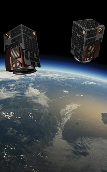
The NewSat constellation will deliver sub-meter resolution imagery to support a wide range of defense applications, including near real-time monitoring, change detection, and enhanced situational awareness for critical operational decisions. These capabilities will enable FAB to improve mission management and increase operational effectiveness.

“This agreement reinforces the position of Telespazio Brasil as a premier provider of geospatial services and solutions to the Brazilian Defense. The partnership with Satellogic further expands our suite of offerings, ensuring our customers benefit from cutting-edge Earth observation technologies and innovative data delivery models”.

Marzio Laurenti, CEO of Telespazio Brasil

Other News & Stories

07.08.2025
Towards the Digital Twin of Italian Soil

Leonardo, through e-GEOS, a company owned by the Italian Space Agency (20%) and Telespazio (80%), will support the Department for Sustainable Development (DiSS) of the Italian Ministry of the Environment and Energy Security (MASE) in the development of a Digital Twin of the Italian territory. The initiative falls under PNRR investment M2C4 I.1.1, which focuses on the development of an advanced monitoring and forecasting system. This high-resolution digital model of the terrain, built using airborne laser surveys (LiDAR) and aerogravimetric data, will serve as a strategic asset for understanding the morphology of the land and will lay the foundation for future Digital Twins capable of simulating and further studying its behaviour.

31.07.2025
U-ELCOME: Hospital Drugs Delivered by Drones Take Off in Abruzzo

The operational phase of the drone-based hospital drug delivery service officially launched today in Abruzzo. The initiative is part of the European U-ELCOME project (U-space European COMmon dEpLoyment), co-funded by the Horizon programme, and aims to foster the widespread adoption of U-space services in European airspace, enabling safe and coordinated operations alongside traditional aircraft.

24.07.2025
Telespazio successfully completes the LEOP of EUMETSAT’s MTG-S1 weather satellite

Telespazio has successfully completed the LEOP (Launch and Early Orbit Phase) operations for the MTG-S1 weather satellite of EUMETSAT, launched on July 1st from Cape Canaveral.

17.07.2025
Telespazio and CNIT organize the first CNCG School on Satellite Navigation Systems

From October 7 to 10, 2025, Telespazio and CNIT – the National Inter-University Consortium for Telecommunications – will host the first CNCG School on Global Navigation Satellite Systems and Related Technologies at Telespazio’s headquarters in Rome.